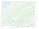
Maps showing Haut-Bertrand, Gloucester, New Brunswick
Haut-Bertrand is a Unincorporated area located in Gloucester, New Brunswick and has an elevation of 31 meters.
- Latitude: 47° 42' 44'' North (decimal: 47.712241)
- Longitude: 65° 6' 50'' West (decimal: -65.1138469)
- Topography Feature Category: Unincorporated area
- Geographical Feature: Suburban Community
- Canadian Province/Territory: New Brunswick
- Elevation: 31 meters
- Location: Gloucester
- Atlas of Canada Locator Map: Haut-Bertrand
- GPS Coordinate Locator Map: Haut-Bertrand Lat/Long
Haut-Bertrand NTS Map Sheets