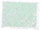
Maps showing Humphreys Wharf, Queens, New Brunswick
Humphreys Wharf is a Marine navigation feature located in Queens, New Brunswick and has an elevation of 17 meters.
- Latitude: 45° 47' 5'' North (decimal: 45.784762)
- Longitude: 65° 59' 10'' West (decimal: -65.9862314)
- Topography Feature Category: Marine navigation feature
- Geographical Feature: Wharf
- Canadian Province/Territory: New Brunswick
- Elevation: 17 meters
- Location: Queens
- Atlas of Canada Locator Map: Humphreys Wharf
- GPS Coordinate Locator Map: Humphreys Wharf Lat/Long