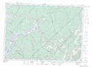
Maps showing Long Creek, Queens, New Brunswick
Long Creek is a River located in Queens, New Brunswick and has an elevation of 5 meters.
- Latitude: 45° 54' 6'' North (decimal: 45.9016663)
- Longitude: 65° 48' 12'' West (decimal: -65.8033956)
- Topography Feature Category: River
- Geographical Feature: Creek
- Canadian Province/Territory: New Brunswick
- Elevation: 5 meters
- Location: Queens
- Atlas of Canada Locator Map: Long Creek
- GPS Coordinate Locator Map: Long Creek Lat/Long