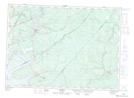
Maps showing Mowatt Brook, Sunbury, New Brunswick
Mowatt Brook is a River located in Sunbury, New Brunswick and has an elevation of 86 meters.
- Latitude: 46° 13' 33'' North (decimal: 46.2259353)
- Longitude: 65° 58' 52'' West (decimal: -65.9810116)
- Topography Feature Category: River
- Geographical Feature: Brook
- Canadian Province/Territory: New Brunswick
- Elevation: 86 meters
- Location: Sunbury
- Atlas of Canada Locator Map: Mowatt Brook
- GPS Coordinate Locator Map: Mowatt Brook Lat/Long
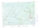
Mowatt Brook NTS Map Sheets