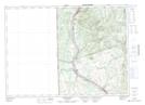
Maps showing Muniac Stream, Victoria, New Brunswick
Muniac Stream is a River located in Victoria, New Brunswick and has an elevation of 117 meters.
- Latitude: 46° 37' 12'' North (decimal: 46.6198784)
- Longitude: 67° 42' 2'' West (decimal: -67.7005816)
- Topography Feature Category: River
- Geographical Feature: Stream
- Canadian Province/Territory: New Brunswick
- Elevation: 117 meters
- Location: Victoria
- Atlas of Canada Locator Map: Muniac Stream
- GPS Coordinate Locator Map: Muniac Stream Lat/Long
Muniac Stream NTS Map Sheets