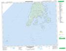
Maps showing Nantucket Island, Charlotte, New Brunswick
Nantucket Island is a Island located in Charlotte, New Brunswick and has an elevation of 6 meters.
- Latitude: 44° 41' 52'' North (decimal: 44.6976693)
- Longitude: 66° 43' 20'' West (decimal: -66.7222081)
- Topography Feature Category: Island
- Geographical Feature: Island
- Canadian Province/Territory: New Brunswick
- Elevation: 6 meters
- Location: Charlotte
- Atlas of Canada Locator Map: Nantucket Island
- GPS Coordinate Locator Map: Nantucket Island Lat/Long
Nantucket Island NTS Map Sheets