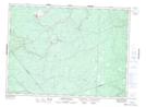
Maps showing Nepisiguit Falls, Gloucester, New Brunswick
Nepisiguit Falls is a Falls located in Gloucester, New Brunswick and has an elevation of 120 meters.
- Latitude: 47° 24' 17'' North (decimal: 47.4047327)
- Longitude: 65° 47' 31'' West (decimal: -65.7920492)
- Topography Feature Category: Falls
- Geographical Feature: Falls
- Canadian Province/Territory: New Brunswick
- Elevation: 120 meters
- Location: Gloucester
- Atlas of Canada Locator Map: Nepisiguit Falls
- GPS Coordinate Locator Map: Nepisiguit Falls Lat/Long
Nepisiguit Falls NTS Map Sheets