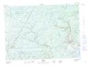
Maps showing Newcastle Creek, Queens, New Brunswick
Newcastle Creek is a Unincorporated area located in Queens, New Brunswick and has an elevation of 15 meters.
- Latitude: 46° 3' 28'' North (decimal: 46.0577233)
- Longitude: 66° 0' 31'' West (decimal: -66.0086682)
- Topography Feature Category: Unincorporated area
- Geographical Feature: Dispersed Rural Community
- Canadian Province/Territory: New Brunswick
- Elevation: 15 meters
- Location: Queens
- Atlas of Canada Locator Map: Newcastle Creek
- GPS Coordinate Locator Map: Newcastle Creek Lat/Long