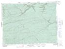
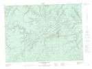
Maps showing North Branch Meadow Brook, Restigouche, New Brunswick
North Branch Meadow Brook is a River located in Restigouche, New Brunswick and has an elevation of 197 meters.
- Latitude: 47° 37' 20'' North (decimal: 47.6222520)
- Longitude: 66° 31' 19'' West (decimal: -66.5218506)
- Topography Feature Category: River
- Geographical Feature: Branch
- Canadian Province/Territory: New Brunswick
- Elevation: 197 meters
- Location: Restigouche
- Atlas of Canada Locator Map: North Branch Meadow Brook
- GPS Coordinate Locator Map: North Branch Meadow Brook Lat/Long
North Branch Meadow Brook NTS Map Sheets