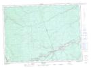
Maps showing North Branch Porter Brook, Northumberland, New Brunswick
North Branch Porter Brook is a River located in Northumberland, New Brunswick and has an elevation of 158 meters.
- Latitude: 46° 33' 8'' North (decimal: 46.5521723)
- Longitude: 66° 24' 55'' West (decimal: -66.4153987)
- Topography Feature Category: River
- Geographical Feature: Branch
- Canadian Province/Territory: New Brunswick
- Elevation: 158 meters
- Location: Northumberland
- Atlas of Canada Locator Map: North Branch Porter Brook
- GPS Coordinate Locator Map: North Branch Porter Brook Lat/Long