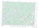
Maps showing Northeast Branch Mill Brook, Queens, New Brunswick
Northeast Branch Mill Brook is a River located in Queens, New Brunswick and has an elevation of 71 meters.
- Latitude: 45° 47' 50'' North (decimal: 45.7970928)
- Longitude: 65° 52' 46'' West (decimal: -65.8793913)
- Topography Feature Category: River
- Geographical Feature: Branch
- Canadian Province/Territory: New Brunswick
- Elevation: 71 meters
- Location: Queens
- Atlas of Canada Locator Map: Northeast Branch Mill Brook
- GPS Coordinate Locator Map: Northeast Branch Mill Brook Lat/Long