Maps showing Oulton Brook, Westmorland, New Brunswick
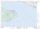
Oulton Brook is a River located in Westmorland, New Brunswick and has an elevation of 2 meters.
- Latitude: 46° 4' 32'' North (decimal: 46.0755460)
- Longitude: 63° 52' 20'' West (decimal: -63.8722207)
- Topography Feature Category: River
- Geographical Feature: Brook
- Canadian Province/Territory: New Brunswick
- Elevation: 2 meters
- Location: Westmorland
- Atlas of Canada Locator Map: Oulton Brook
- GPS Coordinate Locator Map: Oulton Brook Lat/Long
Oulton Brook NTS Map Sheets