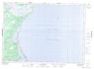
Maps showing Palmer Creek, Kent, New Brunswick
Palmer Creek is a Bay located in Kent, New Brunswick and has an elevation of 1 meters.
- Latitude: 46° 51' 15'' North (decimal: 46.8542644)
- Longitude: 64° 56' 48'' West (decimal: -64.9467115)
- Topography Feature Category: Bay
- Geographical Feature: Creek
- Canadian Province/Territory: New Brunswick
- Elevation: 1 meters
- Location: Kent
- Atlas of Canada Locator Map: Palmer Creek
- GPS Coordinate Locator Map: Palmer Creek Lat/Long
Palmer Creek NTS Map Sheets