Canada Topographic Maps

Restigouche River Topo Maps

Topography maps and Latitude/Longitude Location

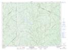
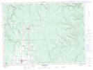
Maps showing Restigouche River, Restigouche, New Brunswick

Restigouche River is a River located in Restigouche, New Brunswick and has an elevation of 0 meters.

  • Latitude: 48° 4' North   (decimal: 48.0667000)
  • Longitude: 66° 20' West   (decimal: -66.3333000)
  • Topography Feature Category: River
  • Geographical Feature: River
  • Canadian Province/Territory: New Brunswick
  • Elevation: 0 meters
  • Location: Restigouche
  • Atlas of Canada Locator Map: Restigouche River
  • GPS Coordinate Locator Map: Restigouche River Lat/Long

Restigouche River NTS Map Sheets

021N09 Grandmaison Topographic Map at 1:50,000 scale

021O11 Kedgwick Topographic Map at 1:50,000 scale

021O14 Menneval Topographic Map at 1:50,000 scale

021O15 Atholville Topographic Map at 1:50,000 scale

022B01 Escuminac Topographic Map at 1:50,000 scale

022B02 Oak-Bay Topographic Map at 1:50,000 scale

021N Edmundston Topographic Map at 1:250,000 scale

021O Campbellton Topographic Map at 1:250,000 scale

022B Matane Topographic Map at 1:250,000 scale

 
Buy Topographic Maps DVD
Newsletter Sign-up

Yes, I want to receive map store discounts.


Bookmark and Share