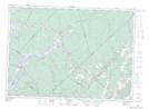
Maps showing Richardsons Cove, Queens, New Brunswick
Richardsons Cove is a Bay located in Queens, New Brunswick and has an elevation of 11 meters.
- Latitude: 45° 52' 53'' North (decimal: 45.8814746)
- Longitude: 65° 49' 33'' West (decimal: -65.8257827)
- Topography Feature Category: Bay
- Geographical Feature: Cove
- Canadian Province/Territory: New Brunswick
- Elevation: 11 meters
- Location: Queens
- Atlas of Canada Locator Map: Richardsons Cove
- GPS Coordinate Locator Map: Richardsons Cove Lat/Long