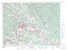
Maps showing Pointu de la Rivière Verte, Madawaska, New Brunswick
Pointu de la Rivière Verte is a Mountain located in Madawaska, New Brunswick and has an elevation of 362 meters.
- Latitude: 47° 22' 57'' North (decimal: 47.3824809)
- Longitude: 68° 7' 53'' West (decimal: -68.1313719)
- Topography Feature Category: Mountain
- Geographical Feature: Pointu
- Canadian Province/Territory: New Brunswick
- Elevation: 362 meters
- Location: Madawaska
- Atlas of Canada Locator Map: Pointu de la Rivière Verte
- GPS Coordinate Locator Map: Pointu de la Rivière Verte Lat/Long
Pointu de la Rivière Verte NTS Map Sheets