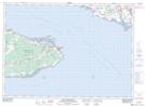
Maps showing Robinson Creek, Westmorland, New Brunswick
Robinson Creek is a River located in Westmorland, New Brunswick and has an elevation of 7 meters.
- Latitude: 46° 10' 14'' North (decimal: 46.1705751)
- Longitude: 63° 57' 49'' West (decimal: -63.963496)
- Topography Feature Category: River
- Geographical Feature: Creek
- Canadian Province/Territory: New Brunswick
- Elevation: 7 meters
- Location: Westmorland
- Atlas of Canada Locator Map: Robinson Creek
- GPS Coordinate Locator Map: Robinson Creek Lat/Long
Robinson Creek NTS Map Sheets