Maps showing Mount Robinson, Northumberland, New Brunswick
Mount Robinson is a Mountain located in Northumberland, New Brunswick and has an elevation of 595 meters.
- Latitude: 47° 8' 55'' North (decimal: 47.1485110)
- Longitude: 66° 27' 59'' West (decimal: -66.4664976)
- Topography Feature Category: Mountain
- Geographical Feature: Mount
- Canadian Province/Territory: New Brunswick
- Elevation: 595 meters
- Location: Northumberland
- Atlas of Canada Locator Map: Mount Robinson
- GPS Coordinate Locator Map: Mount Robinson Lat/Long
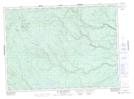
Mount Robinson NTS Map Sheets