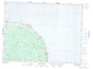
Maps showing Pointe Rochette, Gloucester, New Brunswick
Pointe Rochette is a Cape located in Gloucester, New Brunswick and has an elevation of 3 meters.
- Latitude: 47° 46' 59'' North (decimal: 47.7830919)
- Longitude: 65° 42' 27'' West (decimal: -65.7073766)
- Topography Feature Category: Cape
- Geographical Feature: Pointe
- Canadian Province/Territory: New Brunswick
- Elevation: 3 meters
- Location: Gloucester
- Atlas of Canada Locator Map: Pointe Rochette
- GPS Coordinate Locator Map: Pointe Rochette Lat/Long
Pointe Rochette NTS Map Sheets