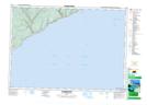
Maps showing Rody Lake, Saint John, New Brunswick
Rody Lake is a Lake located in Saint John, New Brunswick and has an elevation of 198 meters.
- Latitude: 45° 25' 36'' North (decimal: 45.4267093)
- Longitude: 65° 28' 5'' West (decimal: -65.4679343)
- Topography Feature Category: Lake
- Geographical Feature: Lake
- Canadian Province/Territory: New Brunswick
- Elevation: 198 meters
- Location: Saint John
- Atlas of Canada Locator Map: Rody Lake
- GPS Coordinate Locator Map: Rody Lake Lat/Long
Rody Lake NTS Map Sheets