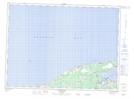
Maps showing Pointe aux Roseaux, Gloucester, New Brunswick
Pointe aux Roseaux is a Cape located in Gloucester, New Brunswick and has an elevation of 2 meters.
- Latitude: 47° 46' 41'' North (decimal: 47.7781068)
- Longitude: 65° 2' 5'' West (decimal: -65.0347518)
- Topography Feature Category: Cape
- Geographical Feature: Pointe
- Canadian Province/Territory: New Brunswick
- Elevation: 2 meters
- Location: Gloucester
- Atlas of Canada Locator Map: Pointe aux Roseaux
- GPS Coordinate Locator Map: Pointe aux Roseaux Lat/Long
Pointe aux Roseaux NTS Map Sheets