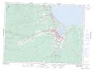
Maps showing Rough Waters, Gloucester, New Brunswick
Rough Waters is a Unincorporated area located in Gloucester, New Brunswick and has an elevation of 24 meters.
- Latitude: 47° 35' 23'' North (decimal: 47.5897247)
- Longitude: 65° 38' 28'' West (decimal: -65.6412478)
- Topography Feature Category: Unincorporated area
- Geographical Feature: Dispersed Rural Community
- Canadian Province/Territory: New Brunswick
- Elevation: 24 meters
- Location: Gloucester
- Atlas of Canada Locator Map: Rough Waters
- GPS Coordinate Locator Map: Rough Waters Lat/Long