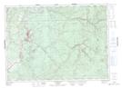
Maps showing Roulston Lake, Victoria, New Brunswick
Roulston Lake is a Lake located in Victoria, New Brunswick and has an elevation of 152 meters.
- Latitude: 46° 53' 40'' North (decimal: 46.8943105)
- Longitude: 67° 24' 00'' West (decimal: -67.3999547)
- Topography Feature Category: Lake
- Geographical Feature: Lake
- Canadian Province/Territory: New Brunswick
- Elevation: 152 meters
- Location: Victoria
- Atlas of Canada Locator Map: Roulston Lake
- GPS Coordinate Locator Map: Roulston Lake Lat/Long
Roulston Lake NTS Map Sheets