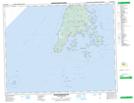
Maps showing Round Pond, Charlotte, New Brunswick
Round Pond is a Lake located in Charlotte, New Brunswick and has an elevation of 97 meters.
- Latitude: 44° 43' 22'' North (decimal: 44.7227855)
- Longitude: 66° 49' 24'' West (decimal: -66.8232362)
- Topography Feature Category: Lake
- Geographical Feature: Pond
- Canadian Province/Territory: New Brunswick
- Elevation: 97 meters
- Location: Charlotte
- Atlas of Canada Locator Map: Round Pond
- GPS Coordinate Locator Map: Round Pond Lat/Long
Round Pond NTS Map Sheets