Maps showing Shepody Bay, Westmorland, New Brunswick
Shepody Bay is a Bay located in Westmorland, New Brunswick and has an elevation of 0 meters.
- Latitude: 45° 44' 17'' North (decimal: 45.7381496)
- Longitude: 64° 35' 24'' West (decimal: -64.5899297)
- Topography Feature Category: Bay
- Geographical Feature: Bay
- Canadian Province/Territory: New Brunswick
- Elevation: 0 meters
- Location: Westmorland
- Atlas of Canada Locator Map: Shepody Bay
- GPS Coordinate Locator Map: Shepody Bay Lat/Long
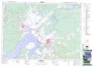
Shepody Bay NTS Map Sheets