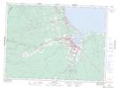
Maps showing Ste. Louise, New Brunswick
Ste. Louise is a Unincorporated area located in New Brunswick.
- Latitude: 47° 41' North (decimal: 47.6833000)
- Longitude: 65° 48' West (decimal: -65.7999999)
- Topography Feature Category: Unincorporated area
- Geographical Feature: Settlement
- Canadian Province/Territory: New Brunswick
- GPS Coordinate Locator Map: Ste. Louise Lat/Long