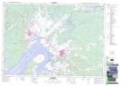
Maps showing Aboushagan Road, Westmorland, New Brunswick
Aboushagan Road is a Unincorporated area located in Westmorland, New Brunswick and has an elevation of 18 meters.
- Latitude: 45° 59' 5'' North (decimal: 45.9846598)
- Longitude: 64° 21' 11'' West (decimal: -64.3529929)
- Topography Feature Category: Unincorporated area
- Geographical Feature: Locality
- Canadian Province/Territory: New Brunswick
- Elevation: 18 meters
- Location: Westmorland
- Atlas of Canada Locator Map: Aboushagan Road
- GPS Coordinate Locator Map: Aboushagan Road Lat/Long