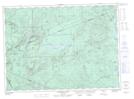
Maps showing Mount Adams, Northumberland, New Brunswick
Mount Adams is a Mountain located in Northumberland, New Brunswick and has an elevation of 522 meters.
- Latitude: 47° 19' 50'' North (decimal: 47.3304351)
- Longitude: 66° 31' 58'' West (decimal: -66.5328282)
- Topography Feature Category: Mountain
- Geographical Feature: Mount
- Canadian Province/Territory: New Brunswick
- Elevation: 522 meters
- Location: Northumberland
- Atlas of Canada Locator Map: Mount Adams
- GPS Coordinate Locator Map: Mount Adams Lat/Long
Mount Adams NTS Map Sheets