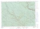
Maps showing Akroyd Gulch, Restigouche, New Brunswick
Akroyd Gulch is a Valley located in Restigouche, New Brunswick and has an elevation of 347 meters.
- Latitude: 47° 50' 57'' North (decimal: 47.8492498)
- Longitude: 67° 32' 55'' West (decimal: -67.5485307)
- Topography Feature Category: Valley
- Geographical Feature: Gulch
- Canadian Province/Territory: New Brunswick
- Elevation: 347 meters
- Location: Restigouche
- Atlas of Canada Locator Map: Akroyd Gulch
- GPS Coordinate Locator Map: Akroyd Gulch Lat/Long
Akroyd Gulch NTS Map Sheets