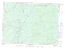
Maps showing Alagash Heath, Kent, New Brunswick
Alagash Heath is a Low vegetation located in Kent, New Brunswick and has an elevation of 109 meters.
- Latitude: 46° 29' 8'' North (decimal: 46.4854198)
- Longitude: 65° 38' 17'' West (decimal: -65.6381537)
- Topography Feature Category: Low vegetation
- Geographical Feature: Heath
- Canadian Province/Territory: New Brunswick
- Elevation: 109 meters
- Location: Kent
- Atlas of Canada Locator Map: Alagash Heath
- GPS Coordinate Locator Map: Alagash Heath Lat/Long
Alagash Heath NTS Map Sheets