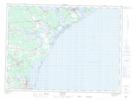
Maps showing Pointe à Allard, Gloucester, New Brunswick
Pointe à Allard is a Cape located in Gloucester, New Brunswick and has an elevation of 4 meters.
- Latitude: 47° 40' 17'' North (decimal: 47.6714228)
- Longitude: 64° 52' 43'' West (decimal: -64.8787423)
- Topography Feature Category: Cape
- Geographical Feature: Pointe
- Canadian Province/Territory: New Brunswick
- Elevation: 4 meters
- Location: Gloucester
- Atlas of Canada Locator Map: Pointe à Allard
- GPS Coordinate Locator Map: Pointe à Allard Lat/Long