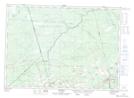
Maps showing Alward, Queens, New Brunswick
Alward is a Unincorporated area located in Queens, New Brunswick and has an elevation of 105 meters.
- Latitude: 46° 12' 23'' North (decimal: 46.2062639)
- Longitude: 65° 25' 46'' West (decimal: -65.429354)
- Topography Feature Category: Unincorporated area
- Geographical Feature: Railway Point
- Canadian Province/Territory: New Brunswick
- Elevation: 105 meters
- Location: Queens
- Atlas of Canada Locator Map: Alward
- GPS Coordinate Locator Map: Alward Lat/Long