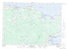
Maps showing Memramcook River, Westmorland, New Brunswick
Memramcook River is a River located in Westmorland, New Brunswick and has an elevation of 4 meters.
- Latitude: 45° 52' 2'' North (decimal: 45.8671276)
- Longitude: 64° 33' 5'' West (decimal: -64.5514993)
- Topography Feature Category: River
- Geographical Feature: River
- Canadian Province/Territory: New Brunswick
- Elevation: 4 meters
- Location: Westmorland
- Atlas of Canada Locator Map: Memramcook River
- GPS Coordinate Locator Map: Memramcook River Lat/Long
Memramcook River NTS Map Sheets