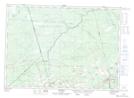
Maps showing Petitcodiac River, Westmorland; Albert, New Brunswick
Petitcodiac River is a River located in Westmorland; Albert, New Brunswick and has an elevation of 7 meters.
- Latitude: 45° 51' 59'' North (decimal: 45.866334)
- Longitude: 64° 34' 29'' West (decimal: -64.5746420)
- Topography Feature Category: River
- Geographical Feature: River
- Canadian Province/Territory: New Brunswick
- Elevation: 7 meters
- Location: Westmorland; Albert
- Atlas of Canada Locator Map: Petitcodiac River
- GPS Coordinate Locator Map: Petitcodiac River Lat/Long
Petitcodiac River NTS Map Sheets