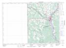
Maps showing Gibson Creek, Carleton, New Brunswick
Gibson Creek is a River located in Carleton, New Brunswick and has an elevation of 55 meters.
- Latitude: 46° 3' 26'' North (decimal: 46.0573464)
- Longitude: 67° 33' 3'' West (decimal: -67.5507935)
- Topography Feature Category: River
- Geographical Feature: Creek
- Canadian Province/Territory: New Brunswick
- Elevation: 55 meters
- Location: Carleton
- Atlas of Canada Locator Map: Gibson Creek
- GPS Coordinate Locator Map: Gibson Creek Lat/Long
Gibson Creek NTS Map Sheets