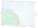
Maps showing Antinouri Lake Brook, Restigouche, New Brunswick
Antinouri Lake Brook is a River located in Restigouche, New Brunswick and has an elevation of 105 meters.
- Latitude: 47° 49' 28'' North (decimal: 47.8244556)
- Longitude: 66° 2' 11'' West (decimal: -66.0362600)
- Topography Feature Category: River
- Geographical Feature: Brook
- Canadian Province/Territory: New Brunswick
- Elevation: 105 meters
- Location: Restigouche
- Atlas of Canada Locator Map: Antinouri Lake Brook
- GPS Coordinate Locator Map: Antinouri Lake Brook Lat/Long
Antinouri Lake Brook NTS Map Sheets