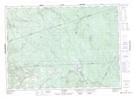
Maps showing Argyle, Carleton, New Brunswick
Argyle is a Unincorporated area located in Carleton, New Brunswick and has an elevation of 326 meters.
- Latitude: 46° 30' 44'' North (decimal: 46.5122985)
- Longitude: 67° 20' 25'' West (decimal: -67.3403297)
- Topography Feature Category: Unincorporated area
- Geographical Feature: Dispersed Rural Community
- Canadian Province/Territory: New Brunswick
- Elevation: 326 meters
- Location: Carleton
- Atlas of Canada Locator Map: Argyle
- GPS Coordinate Locator Map: Argyle Lat/Long