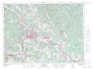
Maps showing Saint-Basile, Madawaska, New Brunswick
Saint-Basile is a Unincorporated area located in Madawaska, New Brunswick and has an elevation of 161 meters.
- Latitude: 47° 21' 20'' North (decimal: 47.3554824)
- Longitude: 68° 13' 25'' West (decimal: -68.2236592)
- Topography Feature Category: Unincorporated area
- Geographical Feature: Urban Community
- Canadian Province/Territory: New Brunswick
- Elevation: 161 meters
- Location: Madawaska
- Atlas of Canada Locator Map: Saint-Basile
- GPS Coordinate Locator Map: Saint-Basile Lat/Long
Saint-Basile NTS Map Sheets