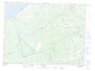
Maps showing Lac Saint-Coeur, Gloucester, New Brunswick
Lac Saint-Coeur is a Lake located in Gloucester, New Brunswick and has an elevation of 46 meters.
- Latitude: 47° 34' 25'' North (decimal: 47.5735328)
- Longitude: 65° 10' 21'' West (decimal: -65.172535)
- Topography Feature Category: Lake
- Geographical Feature: Lac
- Canadian Province/Territory: New Brunswick
- Elevation: 46 meters
- Location: Gloucester
- Atlas of Canada Locator Map: Lac Saint-Coeur
- GPS Coordinate Locator Map: Lac Saint-Coeur Lat/Long
Lac Saint-Coeur NTS Map Sheets