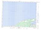
Maps showing Sainte-Anne-du-Bocage, Gloucester, New Brunswick
Sainte-Anne-du-Bocage is a Unincorporated area located in Gloucester, New Brunswick and has an elevation of 11 meters.
- Latitude: 47° 46' 24'' North (decimal: 47.7732482)
- Longitude: 65° 0' 53'' West (decimal: -65.0148471)
- Topography Feature Category: Unincorporated area
- Geographical Feature: Suburban Community
- Canadian Province/Territory: New Brunswick
- Elevation: 11 meters
- Location: Gloucester
- Atlas of Canada Locator Map: Sainte-Anne-du-Bocage
- GPS Coordinate Locator Map: Sainte-Anne-du-Bocage Lat/Long
Sainte-Anne-du-Bocage NTS Map Sheets