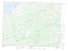
Maps showing Saint-Isidore, Gloucester, New Brunswick
Saint-Isidore is a Village located in Gloucester, New Brunswick and has an elevation of 65 meters.
- Latitude: 47° 33' 18'' North (decimal: 47.5550811)
- Longitude: 65° 2' 48'' West (decimal: -65.0466358)
- Topography Feature Category: Village
- Geographical Feature: Village
- Canadian Province/Territory: New Brunswick
- Elevation: 65 meters
- Location: Gloucester
- Atlas of Canada Locator Map: Saint-Isidore
- GPS Coordinate Locator Map: Saint-Isidore Lat/Long
Saint-Isidore NTS Map Sheets