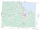
Maps showing Saint-Laurent, Gloucester, New Brunswick
Saint-Laurent is a Unincorporated area located in Gloucester, New Brunswick and has an elevation of 70 meters.
- Latitude: 47° 43' 27'' North (decimal: 47.7240482)
- Longitude: 65° 46' 28'' West (decimal: -65.7745681)
- Topography Feature Category: Unincorporated area
- Geographical Feature: Dispersed Rural Community
- Canadian Province/Territory: New Brunswick
- Elevation: 70 meters
- Location: Gloucester
- Atlas of Canada Locator Map: Saint-Laurent
- GPS Coordinate Locator Map: Saint-Laurent Lat/Long