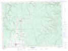
Maps showing Saint-Quentin, Restigouche, New Brunswick
Saint-Quentin is a Town located in Restigouche, New Brunswick and has an elevation of 283 meters.
- Latitude: 47° 30' 49'' North (decimal: 47.5135482)
- Longitude: 67° 23' 32'' West (decimal: -67.3922850)
- Topography Feature Category: Town
- Geographical Feature: Town
- Canadian Province/Territory: New Brunswick
- Elevation: 283 meters
- Location: Restigouche
- Atlas of Canada Locator Map: Saint-Quentin
- GPS Coordinate Locator Map: Saint-Quentin Lat/Long
Saint-Quentin NTS Map Sheets