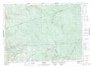
Maps showing First Elliott Brook, Carleton, New Brunswick
First Elliott Brook is a River located in Carleton, New Brunswick and has an elevation of 427 meters.
- Latitude: 46° 39' 44'' North (decimal: 46.6622368)
- Longitude: 67° 24' 26'' West (decimal: -67.4071169)
- Topography Feature Category: River
- Geographical Feature: Brook
- Canadian Province/Territory: New Brunswick
- Elevation: 427 meters
- Location: Carleton
- Atlas of Canada Locator Map: First Elliott Brook
- GPS Coordinate Locator Map: First Elliott Brook Lat/Long