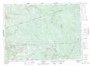
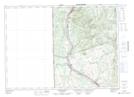
Maps showing Carrol Hill, Carleton, New Brunswick
Carrol Hill is a Mountain located in Carleton, New Brunswick and has an elevation of 388 meters.
- Latitude: 46° 32' 41'' North (decimal: 46.5446093)
- Longitude: 67° 30' 3'' West (decimal: -67.5007692)
- Topography Feature Category: Mountain
- Geographical Feature: Hill
- Canadian Province/Territory: New Brunswick
- Elevation: 388 meters
- Location: Carleton
- Atlas of Canada Locator Map: Carrol Hill
- GPS Coordinate Locator Map: Carrol Hill Lat/Long
Carrol Hill NTS Map Sheets