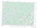
Maps showing Carsonville, Kings, New Brunswick
Carsonville is a Unincorporated area located in Kings, New Brunswick and has an elevation of 118 meters.
- Latitude: 45° 51' 35'' North (decimal: 45.8596978)
- Longitude: 65° 31' 16'' West (decimal: -65.5210792)
- Topography Feature Category: Unincorporated area
- Geographical Feature: Dispersed Rural Community
- Canadian Province/Territory: New Brunswick
- Elevation: 118 meters
- Location: Kings
- Atlas of Canada Locator Map: Carsonville
- GPS Coordinate Locator Map: Carsonville Lat/Long