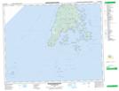
Maps showing Cassie Shoals, Charlotte, New Brunswick
Cassie Shoals is a Shoal located in Charlotte, New Brunswick.
- Latitude: 44° 34' 30'' North (decimal: 44.5749999)
- Longitude: 66° 48' 30'' West (decimal: -66.8082999)
- Topography Feature Category: Shoal
- Geographical Feature: Shoals
- Canadian Province/Territory: New Brunswick
- Location: Charlotte
- Atlas of Canada Locator Map: Cassie Shoals
- GPS Coordinate Locator Map: Cassie Shoals Lat/Long
Cassie Shoals NTS Map Sheets