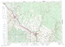
Maps showing Lac Castonguay, Madawaska, New Brunswick
Lac Castonguay is a Lake located in Madawaska, New Brunswick and has an elevation of 259 meters.
- Latitude: 47° 10' 59'' North (decimal: 47.1829589)
- Longitude: 67° 44' 24'' West (decimal: -67.7400285)
- Topography Feature Category: Lake
- Geographical Feature: Lac
- Canadian Province/Territory: New Brunswick
- Elevation: 259 meters
- Location: Madawaska
- Atlas of Canada Locator Map: Lac Castonguay
- GPS Coordinate Locator Map: Lac Castonguay Lat/Long
Lac Castonguay NTS Map Sheets