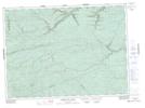
Maps showing Cedar Lake, Restigouche, New Brunswick
Cedar Lake is a Lake located in Restigouche, New Brunswick and has an elevation of 302 meters.
- Latitude: 47° 40' 28'' North (decimal: 47.6743098)
- Longitude: 66° 22' 42'' West (decimal: -66.3782658)
- Topography Feature Category: Lake
- Geographical Feature: Lake
- Canadian Province/Territory: New Brunswick
- Elevation: 302 meters
- Location: Restigouche
- Atlas of Canada Locator Map: Cedar Lake
- GPS Coordinate Locator Map: Cedar Lake Lat/Long
Cedar Lake NTS Map Sheets