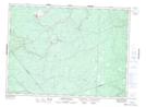
Maps showing Chain of Rocks Rapids, Gloucester, New Brunswick
Chain of Rocks Rapids is a Rapids located in Gloucester, New Brunswick and has an elevation of 71 meters.
- Latitude: 47° 24' 23'' North (decimal: 47.4063336)
- Longitude: 65° 43' 29'' West (decimal: -65.7248221)
- Topography Feature Category: Rapids
- Geographical Feature: Rapids
- Canadian Province/Territory: New Brunswick
- Elevation: 71 meters
- Location: Gloucester
- Atlas of Canada Locator Map: Chain of Rocks Rapids
- GPS Coordinate Locator Map: Chain of Rocks Rapids Lat/Long
Chain of Rocks Rapids NTS Map Sheets